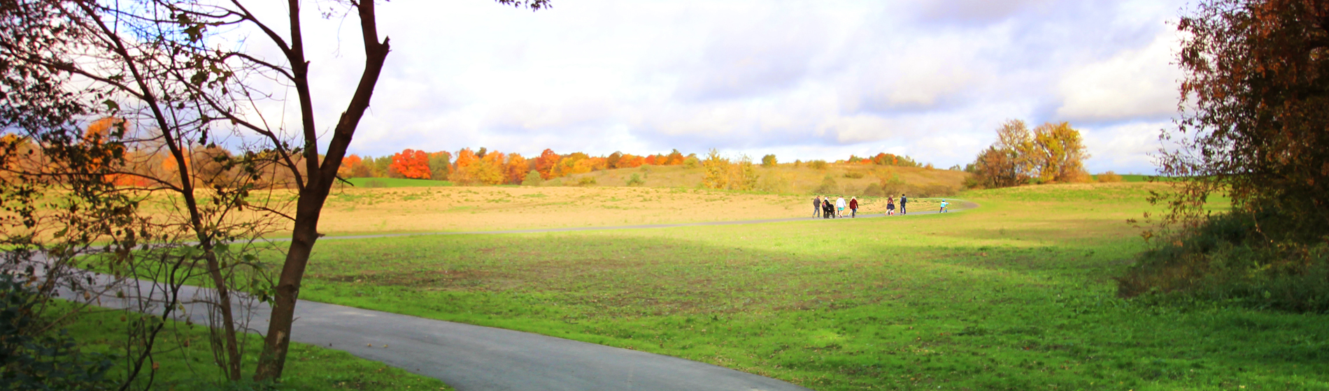
-
Explore Canada's Trail Capital
-
Overview
Welcome to The Trails of Uxbridge Township!
Uxbridge Township boasts hundreds of kilometers of trails running through our communities and our rural, forested lands. Working in cooperation with Conservation Authorities and volunteers, a number of major trail systems pass through the Township, including the Oak Ridges and Trans Canada Trails, and trails within 8,000 acres of conservation lands.
Enjoy a trip through the historic Town of Uxbridge, using one of our many and accessible Town Trails.
Uxbridge Township has recently received federal designation by Industry Canada as The Trail Capital of Canada, and with good reason! Uxbridge Township welcomes visitors to enjoy the natural beauty and many benefits of our beautiful trails.
Here are a few reasons to enjoy the Trails of Uxbridge Township:
- Uxbridge Township is located in Ontario’s Durham Region, one hour northeast of Toronto
- We have over 220 kilometers of managed trails on over 8,000 acres of protected greenspace
- 85% of Uxbridge citizens are within a 10-minute walk, cycle or drive to a Trail
- Trails are developed and managed through a collaboration between local municipalities and other forms of government, citizens and volunteers, private and commercial landowners, conservation organizations,businesses and associations
- Trails are multi-use and are a well-known destination for hiking,cycling, horseback riding, cross-country
- Skiing and limited snowmobiling
- Uxbridge Trails help preserve and renew natural environments including a leading-edge gravel pit restoration project
- Within the next five years, Uxbridge has plans to increase its network of trails and also to actively Encourage a direct “green” link between Uxbridge and the Greater Toronto Area, Canada’s largest Metropolitan region of 5.5 million people
- Uxbridge Trails run through historic villages, mixed forests, streams, wetlands, and meadows with an abundance of flora and fauna.
Trail Etiquette
We welcome you to enjoy our Trails, and to please remember and respect the following points of etiquette:
- Read the description for the trail you are planning to enjoy and follow the guidelines
- Stay on the marked trails and do not take shortcuts
- Keep pets on a leash and clean up after them
- Respect the private property of residents living along the trails
- Stay to the right on a trail, and pass on the left
- Be courteous to fellow trail users
- Bike riders yield to both hikers and horseback riders; hikers yield to horseback riders
- Leave all trees, leaves, wood, rocks and plants for others to enjoy
- Remove all litter and leave the trail cleaner than you found it
- Respect the sounds of nature and avoid loud noises
Urban Walking Poles – New!
Urban Walking Poles are lightweight, handheld poles that add stability and added fitness benefit to your next walk on the trails. Burn more calories and reduce stress on the body during a walk with urban poles. People of all ages and fitness levels benefit from this fun and social form of exercise. Urban walking poles can be used on any Town or Countryside Trail, at any time of year.
Urban Walking Poles are now available for rent from the Township of Uxbridge through Uxpool. Rental fees are: $5.00 per day; $10 per weekend; $15 per week. Deposit required.
Geocaching
The ultimate high-tech treasure hunt!! Geocaching is a great outdoor activity where you search for hidden containers using only a handheld GPS with geographical coordinates. It is enjoyed throughout the world by people of all ages, and is a fantastic way to explore places that you have never been before. Kids particularly enjoy the idea of finding a treasure at the end of a hunt!
Most geocaches contain a log book to record all of the visitors and some small toy trinkets. Remember to bring along some trinkets of your own, as the etiquette is to replace any trinkets you take with one of your own so that the treasure will always be replenished. There are over 850,000 geocaches hidden around the world, including a number of geocaches hidden on the trail systems of Uxbridge Township. For detailed information and a free membership, log on to www.geocaching.com for more information.
Links to Other Local Attractions
- Uxbridge Local Heritage Attractions
- Local Events
- Foster Memorial
- Lucy Maud Montgomery Society
- York-Durham Hertiage Railway
Countryside Trails
Enjoy the beautiful outdoors on one of the many trail systems found in the Uxbridge countryside. Most trails are recreational and multi-use, with great opportunities for walking, hiking, mountain biking, equestrian, cross country skiing and limited snowmobiling. See the information and links below to view specific details and maps for each trail system. To see an overview map of the Countryside Trails in the southern half of the Township, click here.
South-east Uxbridge -(south of Durham Road 21, east of Brock Road)
South-east Uxbridge
This area is referred to as the East Duffins Headwaters area and is, by far, the most extensive with over 100 km of trails spread over the 1,000 acre Durham Regional Forest main tract, and the 4,000 acres of conservation land managed by the Toronto Region Conservation Authority.
The East Duffins Headwaters area contains mixed sections of hardwood and deciduous forest ranging from flat to hilly topography, and is renowned for its hiking, cross-country skiing, mountain biking and horseback riding. Larger scale maps of individual areas and other related details are available through the links below:
Durham Regional Forest
Lake Simcoe Region Conservation Authority
The Durham Regional Forest, managed by the Lake Simcoe Conservation Authority, has a number of tracts in Uxbridge Township, and is comprised of plantation forests established over 70 years ago, as well as mixed hardwood areas. Located at the top of the Oak Ridges Moraine, the main tract is renowned for its excellent cross-country skiing, mountain biking, hiking and horseback riding.
Glen Major Forest & Walker Woods; Brock Tract; North Walker Woods
Toronto and Region Conservation Authority
Managed by the Toronto Regional Conservation Authority, these areas of environmentally significant forest on the Oak Ridges Moraine have upwards of 50 kilometres of trails cut through mixed deciduous and coniferous forest. Through the TRCA website, you may also find their newsletter called “The Woods” which contains topical articles of interest to trail users.
Oak Ridges Trail
The Oak Ridges Trail Association
The Oak Ridges Moraine is a unique geographical formation that stretches from the Niagara Escarpment eastward to the Trent River watershed. The Moraine passes through some of the most beautiful countryside in Southern Ontario, and contains the headwaters of more than thirty rivers draining into Lakes Simcoe and Ontario. The Oak Ridges Trail extends through Uxbridge Township, from York/Durham Line to Lakeridge Road. The detailed Oak Ridges Trail Guide can be purchased via their website, or by visiting Blue Heron Bookstore in Uxbridge. Also on their website are details of upcoming group hikes, meetings and other information.
Trans Canada Trail
The Trans Canada Trail is a 21,500-kilometre recreational trail winding its way through every province and territory, from the Atlantic to Pacific to Arctic Oceans. When completed, it will be the world's longest recreational trail, linking close to 1000 communities and over 33 million Canadians! This trail enters Uxbridge via the abandoned CN rail line from Lindsay, traverses the Uxbridge urban area, then heads south through Durham Forest lands, the Glen Major Forest and to the Uxbridge-Pickering Townline. There are exciting plans to take this trail off-road as it exits the town.
South-west Uxbridge - (south of Durham Road 21, west of Brock Road
South-west Uxbridge
This area, known as the West Duffins Headwaters area is developing quickly, although formal trails are yet to be opened. Plans are underway to extend trails in the Goodwood Tract and into the 7,200 acre federal Green Space lands with exciting potential future links to the Rouge Park and the urban Greater Toronto Area. Click on the overview map for more details.
North-east Uxbridge - (directly south of the Town of Uxbridge)
North-east Uxbridge
There are numerous trail opportunities in this area, where the countryside meets the town. Check out the Town and Vicinity overview map and the Countryside Preserve map for further details. South of the Countryside Preserve is also a connection to the Duham Regional Forest tract, with access and parking off Wagg Road.
Uxbridge Town Trails
The Uxbridge Town Trail System is a network of trails in the urban area that also connects to the Countryside Trail systems to the south. The aim of the Town Trails is to help residents appreciate the beauty of the town of Uxbridge, to link communities together, to encourage healthy outdoor exercise, and to foster an appreciation of the natural environment.
Uxbridge Township, along with conservationists, volunteers and private partners, under the umbrella of “Uxbridge Naturally, have developed a comprehensive network of “in town” trails and larger trail systems close to town. Historical information is provided by the Uxbridge Historical Centre.
Volunteers! The Town Trails are monitored and maintained by a team of volunteers. Do you enjoy walking the Town Trails? Are you interested in becoming a volunteer? Please contact the Township of Uxbridge at 905-852-9181 or info@town.uxbridge.ca
The Town Trails as well as the Uxbridge Countryside Preserve – 140 acres of rolling meadowland, woodlands and ponds on the edge of town - are listed below. See the Town and Vicinity overview map for details of this entire trail network. By clicking on the following links, you can access detailed information about each trail including a descriptive brochure giving information of local or historical interest, together with a more detailed map and information about accessibility.
Uxbridge Countryside Preserve (6 km) covers 140 acres of rolling meadowland, woodlands, wetlands and ponds, and an abundance of flora and fauna. It is situated on the Oak Ridges Moraine and contains key natural heritage features. Enjoy the spectacular view of the Township from on top of Observation Hill.
Barton Trail (2 km) circles the Barton Farms community and passes by Herrema Fields with its playground and covered picnic area, through the residential streets, along woodland sections and by a pond. The Trail connects to the Trans Canada trail, which runs along a former railway line.
View Map
Butternut Trail (1.5 km) is a loop circling around the Butternut Village community. The paths are all paved, with the exception of the section around the pond. The route takes you through residential areas, including the original farm homestead and the magnificent Butternut tree that gives the development its name.
View Map
Ewen Trail (3.4 km) covers a variety of countryside and urban scenery, including three ponds, a section through Elgin Park, a route through some thickly wooded areas, and a walk along streets containing some of Uxbridge’s most historic homes.
Historic Trail (2.4 km) winds through the oldest parts of Uxbridge. Six historical information plaques use historical photos and brief texts to tell about Uxbridge in “the old days”.
View Map
Maple Bridge Trail (1.5 km), sponsored by Mason Homes, runs along the path of a stream, through lush woodlands with a number of wooden bridges. It is a single path, with a crushed stone base and has an easy connection to Quaker Trail.
View Map
Quaker Trail (2.2 kms.) winds around the Quaker Village residential area in northwest Uxbridge, passing through some of the most historic areas of the town’s past, with access to the Uxbridge Historical Centre (museum). Features a pond, playgrounds and a wide grassy area for picnics and play.
South Balsam Trail (2.5 kms.) provides a variety of outdoor experiences, with about half of the trail winding through forest and newly reforested fields, and about half along town streets. There are benches for peaceful relaxation and access to a pond and a children’s playground.
Wooden Sticks Trail (2 kms.) - a mixture of wooded, street and park environment. The route goes through a dense wooded area, through Elgin Park, with nearby play areas (and washrooms), and through the Estates of Wooden Sticks housing development. A path gives access from the Shobrook Gardens residence for seniors.
New! Indoor Trail – enjoy a walk on Uxbridge’s new “indoor trail” located in the corridors of Uxbridge Secondary School. A nominal membership fee of $10.00 allows you to enjoy a snow and ice-free walk every Tuesday evening from 6:00 – 8:00 pm. Get your membership and further information at Uxpool, or directly at USS on Tuesday evenings. Walking only, no strollers, children walk free of charge and must be accompanied by an adult. Indoor Trail is open from November to February.
View Uxbridge Township Trail Maps:
Township Trail Map
Town Trail Map